In figures
ICARO: expert management system for highways and road networks.
-
> 250.000
KM
-
1.163
Users
-
115
Clients
-
17
Countries
Road Asset Management System
Infrastructures
Pavements, bridges, inventory assets...
Areas
Survey, pavements, traffic, road security...
Management
Planning, scheduling, control…
GEOMETRY
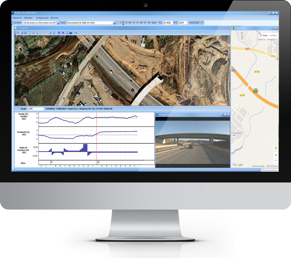
This module displays the geometric data -camber, slope and radius of curvature- of any roadway network in both graphic and numeric formats. Data is obtained by high-performance equipment that measures and records the roadway geometry.
INVENTORY
From road signs, vertical signals, equipment, environment, milestones, and structures, ICARO contains the inventory of all of the network elements on the roadway. Each of them has a personalized file that records its characteristics including location, condition, and a history of actions performed.
ROUTINE MAINTENANCE
This module allows maintenance personnel to generate reports of works and incidents. By keeping this information up-to-date, clients are able to quickly obtain certified reports and information that allow them to make informed decisions on the maintenance and management of the road network.
PAVEMENTS
The module displays the actual structural section of the entire network, as well as the history of all the actions performed on the pavement, with its corresponding characteristics such as date of execution, materials used, and company that performed the work.
CONDITION SURVEY
Through this module, information on the structural and functional condition survey of the pavement can be obtained including historic and statistical values. This data is accessible through tables, histograms, thematics and graphics.
THEMATICS
ICARO allows representing any consultation in mapping thematics, obtaining a visualization that facilitates the interpretation of the results located on the map of the network.
TRAFFIC
By using the latest traffic counts, this module allows automatic calculation of the Level Of Service of the entire network and can show historic traffic count data for comparison.
ROAD SAFETY
This module contains all the information on accidents on the network. ICARO automatically performs Black Spots, the Risk Index and the Mortality Rate – essential data for analyzing road safety on a network.
FLEET MANAGER
This module allows visualization and monitoring of the routes that the maintenance vehicles follow. It may obtain data on performance and work executed (e.g., knowing in real time whether the snowplow blade is up or down).
SEGMENTATION
This module automatically segments in stretches of homogenous behavior. Each of these segments are then characterized by statistical values of survey, so they can be analyzed through the Expert Road Management System.
PAVEMENT MANAGEMENT
Having established the level of quality to be maintained, ICARO indicates the long-term action plan, tailored to the needs of each client/managing entity. The evolution of the parameters is performed following development models based on the experience acquired by RAUROS in the various networks studied from the beginning of the development.
QUERIES
With the latest data in place, the principal use of this tool is its capacity to cross information of various areas. Simply and directly, it enables obtaining specific information. Furthermore, the data obtained may be represented in tables and thematics.
EXPERT MANAGEMENT OF STRUCTURES
This module aims to analyze structural data to ensure the future conditions of the structure, estimating the need for network maintenance and recommending action projects, taking into account budgetary constraints and policy restrictions.
EXPERT MANAGEMENT OF SLOPES
ICARO has slope management systems, allowing inspections to be recorded and condition indicators to be calculated.
-
-
KM
-
Users
Latin America
Mexico, Ecuador, Chile, Brazil, Uruguay, Paraguay, Peru, Panama, and Costa Rica
Europe
Spain, France, Portugal, Italy, and Ireland
Middle East and Asia
United Arab Emirates and India
Africa
Morocco and Tunisia
 Español


